Early Human Settlement Dynamics
BICAEHFID. Biogeographic and cultural adaptations of early hominids during the first intercontinental dispersals
A new research approach based on biogeography and adaptive behaviours to understand the complex human colonisation processes across the Old World.
"BICAEHFID (ERC-Advanced Grants, 2019-2024) suggests the need of a broad geographical approach to the study of early human occupation dynamics by comparing Old World regions containing the longest sequences of early archaeological sites. The project addresses the main research themes related to the study of early human migrations, and proposes a roadmap for understanding the alternative evolutionary trajectories adopted by hominins that shared an overarching biological and cultural background, but who faced different climatic and biogeographic challenges and opportunities."
Ignacio de la Torre
Instituto de Historia. CSIC
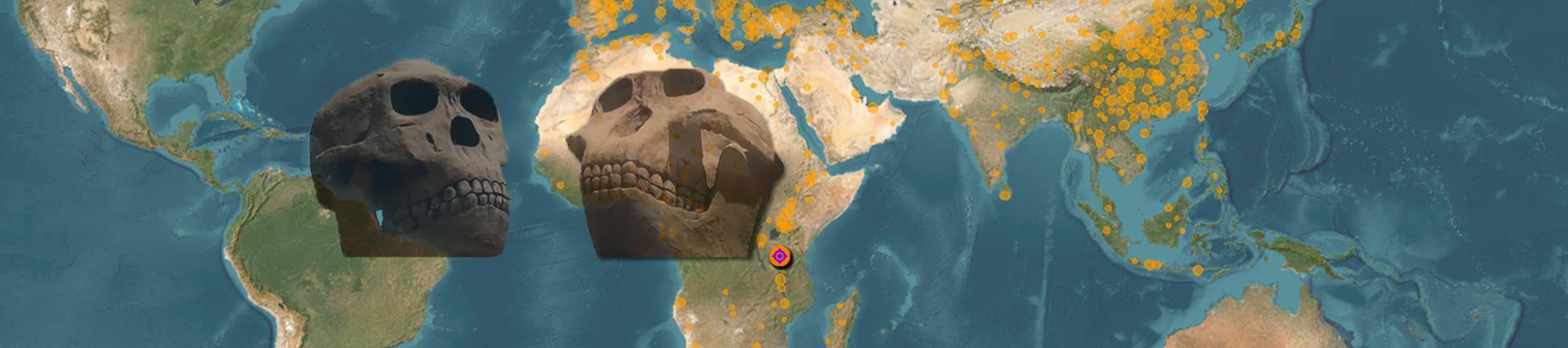
The use of Geographic Information Systems at global and archaeological site scales is key to the study of early human occupation dynamics, based on the comparison of Old World regions containing the longest sequences of early archaeological sites.

Archaeological site in the Olduvai Gorge (Tanzania). Photograph by author
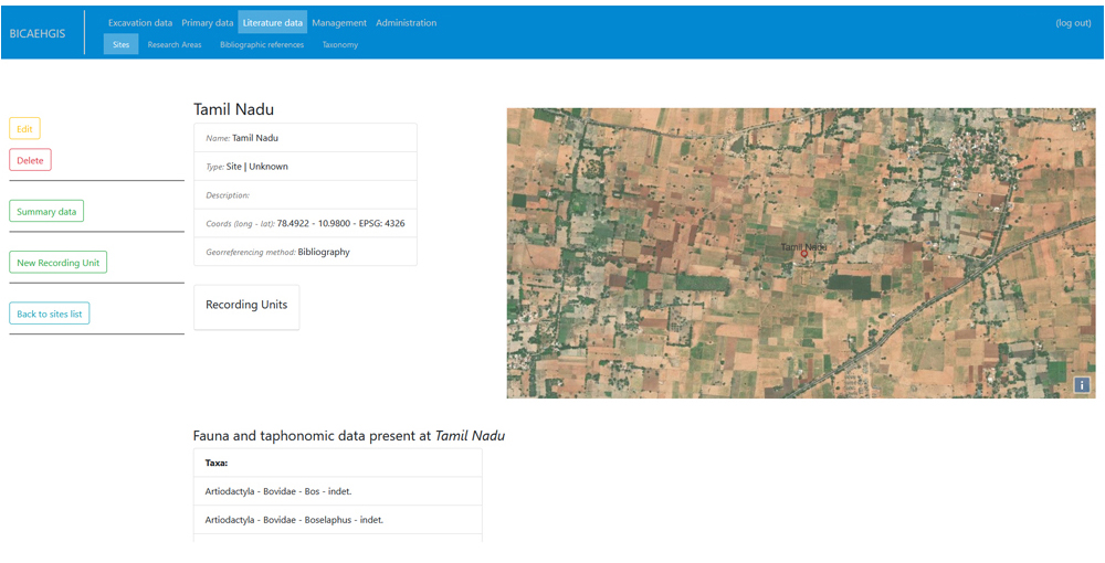
BICAEHFID proposes a joint analysis of primary excavation data and information from bibliographic data collections.
The work of the research group in the Olduvai Gorge (Tanzania) and Nihewan (China) allows the comparison of sequences from early human sites; along with the work carried out in Spain, they make up the core of the primary excavation data. Bibliographic data collections and open databases available online will complete a model to study patterns of evolution and dispersal across the Old World.
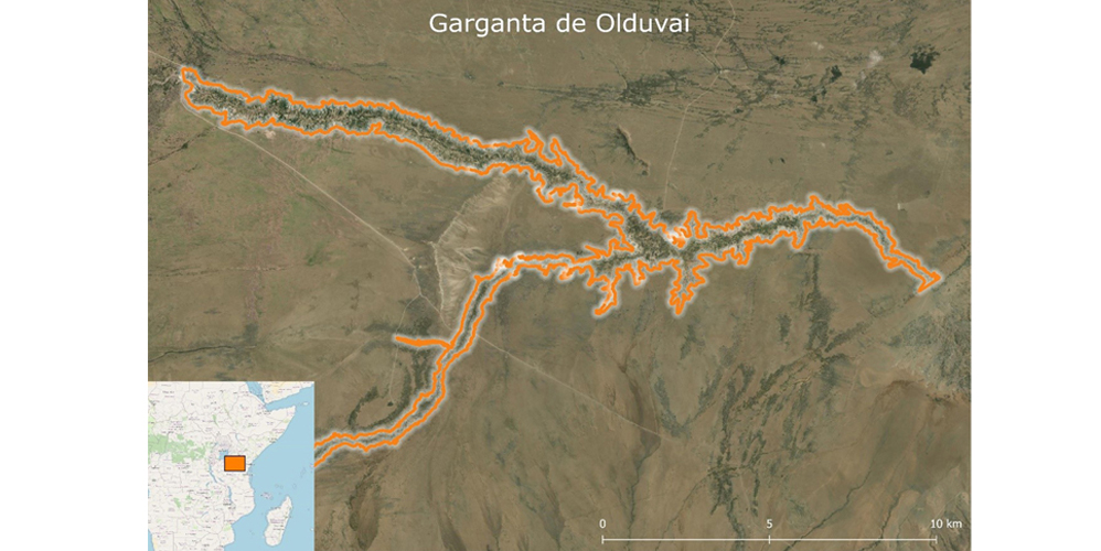
The Olduvai Gorge (Tanzania). Photograph by author

Olduvai Gorge panoramic view. Photograph by author
The development of an in-house Geographic Information System (BICAEHGIS) is a crucial element for the analysis of such an extensive and diverse data set.
The primary source data (excavations) and secondary source data (extensive bibliographic datasets) have been the main challenge when designing the structure of BICAEHGIS, especially considering that publications usually present aggregated data in different forms.
The proposed data model brings together primary and secondary data in a single structure, enabling future combined analyses.
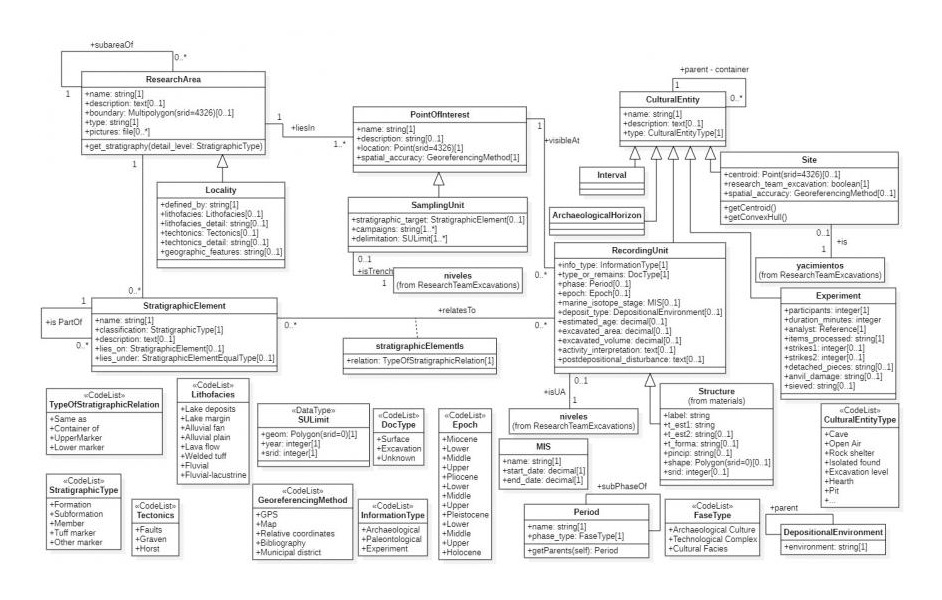
Main module of the data model: research areas and sites
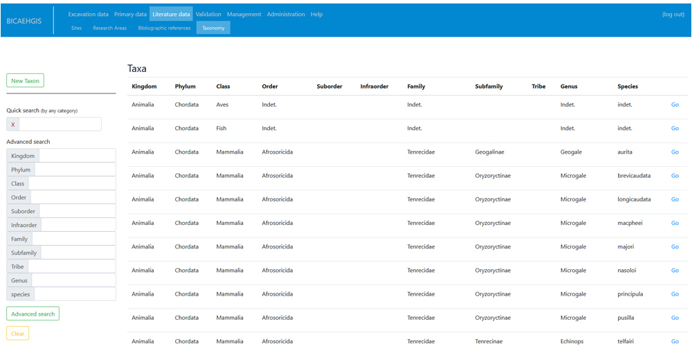
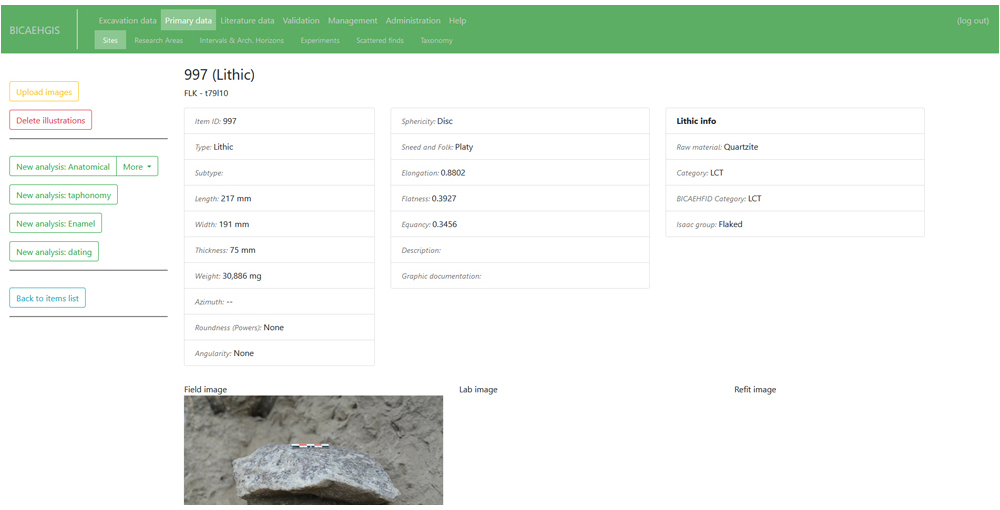
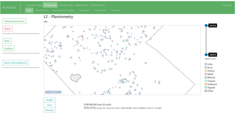
BICAEHGIS allows handling geographic information, excavation data, archaeological material, planimetries, a wide range of analytical results, bibliographic data, etc.
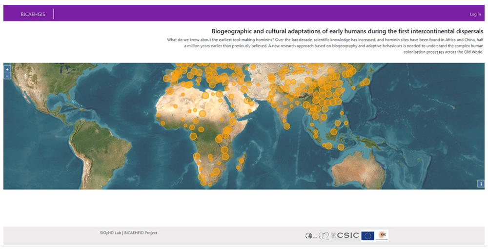
The access to BICAEHGIS consists a web interface accessible to all researchers of this international project.
The same Database integrates:
- i) Data generated by the several specialists: anatomical and taphonomic analysis of bones, physico-chemical dating, isotopic analysis of sediments or tooth enamel...
- ii) Primary data from excavation generated by the Research Group over years of excavations.
- iii) Existing secondary datasets (Chinese sites, paleontological data from the “NOW Database”).
- iv) Bibliographic data collections currently in progress.
I.P.: Ignacio de la Torre Sainz - IH (CSIC)

His main lines of research are the archaeology of human origins, hunter-gatherer societies, lithic technology, and the processes of formation of the Paleolithic archaeological record. Up to date, he has applied this perspective to three geographical and temporal contexts: the archaeology of human origins in the Early Pleistocene of East Africa and Asia, and the archaeology of the Middle and Late Pleistocene in Spain.
read more...